Below is a description of the geology of the Pinnacles and Berea, Kentucky. If you would like to learn about the geology of Kentucky in general, click here.

What rocks are found near Berea, and how did they form?

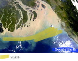
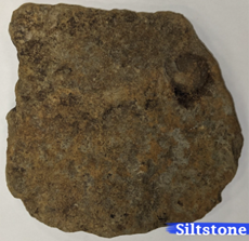
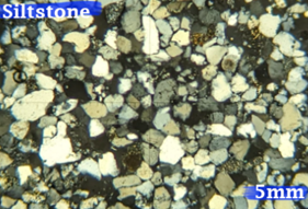
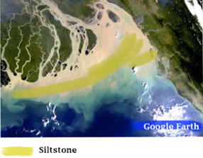
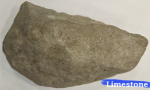
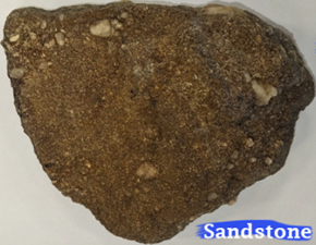
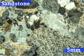
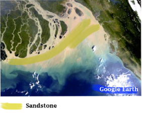
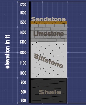
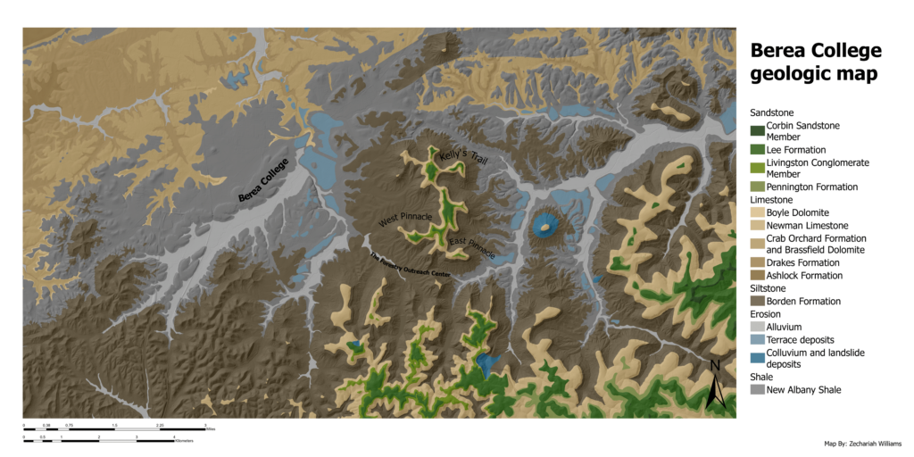
Berea’s five main rocks [shale, siltstone, limestone,sandstone, and conglomerate] formed between 390-310 million years ago during the Paleozoic Era. During this time, Berea was part of a delta environment underwater near the equator in a shallow sea.

In Berea, deltas formed when rivers from what would become the Appalachian mountains started flowing into the sea. Berea is located where the sea and streams met. We know this by examining the shale, siltstone, and sand/conglomerate layers. Rivers are energetic and can carry large clasts (grains of a material). As the river feeds into the sea, the energy dissipates and it deposits sediments; first, the heaviest clasts fall, then the medium, and finally,  the smallest particles. Thus, rocks that formed closer to the coast tend to consist of larger particles like pebbles and sand, whereas rocks that formed further from the coast tend to consist of smaller particles like mud and silt. Below, we describe the main rock types in the Berea area:

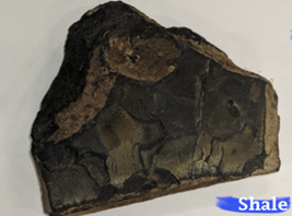
New Albany Shale (Devonian) (Today:800 ft above sea level)

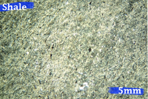
Shale: Formed between 393.3-358.9 Ma.


The oldest exposed rock layer in Berea is shale. Shale is a flat, finely clasted, black rock that formed from low-energy mud deposits on the edge of this ancient delta.

Fossils: Brachiopods, Conodonts(Hindeodella, Siphonodella and Spathognathodus), spores, fish teeth, Hexactinellid Sponge Spicules, Scolecodonts, Horn Coral, Platyrachella, Tylothyris, Spinatrypa and Pectiod Pelecyopod.

Borden Formation (Middle- Early Mississippian)(Today:1250 ft above sea level)

 Siltstone: Formed between 358.9-323.2 Ma.

The layer above the shale is siltstone. This brownish-gray, medium clasted layer of rock formed from sedimentation of silt within an ancient delta. Silt deposits in environments with energy levels between the calm serenity of the shale layer and the high-energy environment of the sandstone conglomerate.

Fossils: Gnathodus Texanus, Lonchodus, Cavussgnathus, Gastropod, Ostracode Steinkern, Fish teeth, Brachiopods, Crinoid Columnals, Bryozoans, Endothyrid Discontinuous, Endothyra, Baileyi, Hebest, Scitula, Tumula, Septabrunsiina, Mckeei Skipp, Holocomb & Gutschick, Tuberitina, Septaglomospiranella, Earlandia, Paracaligella.


Newman Limestone (Late Mississippian)(Today:1450 ft above sea level)

Limestone: Formed between 323.2-315.2 Ma

On top of the siltstone is a layer of limestone. By this point in Berea’s Geologic history, the river delta shifted away from Berea, and a reef formed in its place. The limestone is a remnant of this reef; in this layer, you can find abundant fossilized sea life.

Fossils: Crinoid Columnals, Brachiopods, Blastoides, Horn corals and Bryozoans.


Lee Formation/Pennington Formation (Early Pennsylvanian)( Today:1500 ft above sea level)

Sandstone/Conglomerate: Formed between 315.2-310Ma.

On top of the limestone layer, we find a layer of sandstone and conglomerate, which came from a coastal environment. At this point, the limestone reef reverted back to a delta environment. The sandstone and conglomerate represent high-energy sediment (sand and pebbles) deposited near the mouth of the river. These are some of the largest clasts that we find in the Berea area.

Fossils: Sparse impressions of woody material.

As a reminder: A key marker for deltas is a deposition of sediments from large clasts of sandstone near the mouth of a river; medium clasts of siltstone enclosed within the delta; and small clasts like shale on the edge of the delta. This, with a limestone layer in-between, is what we find in Berea.

By observing these progressive layers of shale, siltstone, limestone, and sandstone, we can learn what happened in the Berea area 300-500 million years ago. During this time, Berea was getting closer and closer to the continental coastline. This happened not because the sea was shrinking but because Berea was rising. The North American and African plates were crashing into each other, helping to form the Appalachian mountains, and Berea was rising along with these mountains.

Geologic maps of Berea College and the Pinnacles

The U.S. Geologic Survey provides free geologic maps of the Pinnacles and Berea College. View by clicking on the maps below.

The Pinnacles

Berea College

If you have any geology questions feel free to email Zechariah Williams at williamsz2@berea.edu.